Tropical Storm Beryl Expected To Make Landfall In US As Hurricane, Then Track North: Timing Tropical Storm Beryl Expected To Make Landfall In US As Hurricane, Then Track North: Timing Tropical Storm Beryl Expected To Make Landfall In US As Hurricane, Then Track North: Timing
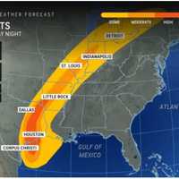
Tropical Storm Beryl Expected To Make Landfall In US As Hurricane, Then Track North: Timing The second named storm of the 2024 hurricane season is projected to trek north through the US this coming week. According to the National Hurricane Center, Tropical Storm Beryl, which is now churning in the Gulf of Mexico, is predicted to make landfall in south Texas as a hurricane on Monday morning, July 8. Beryl strengthened to Category 5 hurricane status last week before making its first landfall—over the island of Carriacou in Grenada. "Beryl could stall over Texas, which may result in excessive rainfall and widespread, major flooding in some areas early week," AccuWeather says. Some …
Pavement Heave Causes Major Traffic Jam On Garden State Parkway Pavement Heave Causes Major Traffic Jam On Garden State Parkway Pavement Heave Causes Major Traffic Jam On Garden State Parkway
Pavement Heave Causes Major Traffic Jam On Garden State Parkway Morning rush hour traffic appeared to be moving smoothly on the Garden State Parkway after buckled pavement caused major delays in Toms River. A pavement heave was found on the southbound side near milepost 82.7, the parkway said on Twitter at 5:47 p.m. on Tuesday, July 2. Emergency repairs forced the right lane to close, causing significant delays during a busy Fourth of July holiday travel week. Heaves can happen when moisture underneath pavement expands during hot weather, especially when temperatures are above 90 degrees, according to AccuWeather. Posted by Scott Binkley on Tuesday,…
Tornados, Heat, Life-Threatening Rip Currents: No Relief Mid-Week For New Jersey, Pennsylvania Tornados, Heat, Life-Threatening Rip Currents: No Relief Mid-Week For New Jersey, Pennsylvania Tornados, Heat, Life-Threatening Rip Currents: No Relief Mid-Week For New Jersey, Pennsylvania
Tornados, Heat, Life-Threatening Rip Currents: No Relief Mid-Week For New Jersey, Pennsylvania It's another hot one in New Jersey in Pennsylvania. And a stormy one. And a dangerous one — both on land and at sea, forecasters warn. Yeah, finding relief Wednesday, June 26 won't be easy. "If you are thinking of getting relief at the beach, there is a High Risk for life threatening rip currents at NJ beaches today (Moderate Risk at DE beaches)," the National Weather Service (NWS) said. "Be sure to only swim where there are lifeguards, and never go in water when the beach is closed." Heat indexes could reach 100 degrees in parts of NJ and PA before storms roll in, the weather map above s…
Potentially Damaging Thunderstorms Expected To Develop In DMV Region, Forecasters Warn Potentially Damaging Thunderstorms Expected To Develop In DMV Region, Forecasters Warn Potentially Damaging Thunderstorms Expected To Develop In DMV Region, Forecasters Warn
Potentially Damaging Thunderstorms Expected To Develop In DMV Region, Forecasters Warn The stifling heat in the DMV on Wednesday could turn into possibly strong or severe storms throughout parts of the region. Temperatures are expected to hover in the 90s throughout the afternoon on June 26 with thunderstorms developing later in the day, with potentially damaging winds that could impact residents in DC, Maryland, and Virginia. Keep an eye on upcoming forecasts for possible storms developing. And stay cool and hydrated out there. https://t.co/zu35K15ssP — Maryland Department of Emergency Management (MDEM) (@MDMEMA) June 26, 2024 According to AccuWeather forecasters, the s…
Extreme Heat, Thunderstorms Return To Northeast: Here's The Timing Extreme Heat, Thunderstorms Return To Northeast: Here's The Timing Extreme Heat, Thunderstorms Return To Northeast: Here's The Timing
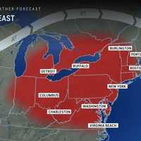
Extreme Heat, Thunderstorms Return To Northeast: Here's The Timing The weather Monday, June 24 was nice, wasn't it? Don't get too comfortable, because the heat and the thunderstorms are both expected to return in New Jersey and Pennsylvania, the National Weather Service says. Tuesday, June 25 will be sunny with a high of 92. The evening will hit a low of 71 before the heat returns even hotter on Wednesday, June 26, the NWS said. "As has been the case with the heat wave in recent days, the biggest spike in temperature and humidity levels will be in the East, rather than the Midwest," AccuWeather says. "Temperatures will peak within a few degrees of 100 fro…
Abnormally Hot July Ahead For Northeast, Forecasters Say Abnormally Hot July Ahead For Northeast, Forecasters Say Abnormally Hot July Ahead For Northeast, Forecasters Say
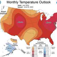
Abnormally Hot July Ahead For Northeast, Forecasters Say Forecasters say July 2024 will be an unforgettable one — but not exactly for the right reasons. The monthly temperature outlook for July was released by the National Oceanic and Atmospheric Administration National Weather Service Climate Prediction Center. A weather map shows next month is shaping up to be between 70 and 80 percent hotter than normal temps for the month of July both in the Northeast and the Midwest. This week could be a good indication of that, as temps have yet to spike and will challenge records, AccuWeather says. AccuWeather Friday, June 21 will be sunny with a …
Excessive Heat Watch Issued For Most Of DMV Region With Temperatures Approaching 100 Degrees Excessive Heat Watch Issued For Most Of DMV Region With Temperatures Approaching 100 Degrees Excessive Heat Watch Issued For Most Of DMV Region With Temperatures Approaching 100 Degrees
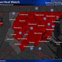
Excessive Heat Watch Issued For Most Of DMV Region With Temperatures Approaching 100 Degrees Forecasters are cautioning that oppressive heat may be headed to the DMV region with temperatures possibly approaching 100 degrees in the area. The National Weather Service announced that an Excessive Heat Watch has been issued for Saturday, June 20 with possible heat index values touching 105 to 110 degrees in certain parts of DC, Maryland, and Virginia. National Weather Service It will be in effect from noon through 8 p.m. on Saturday, June 22. Residents have been advised to:  Stay in air conditioning and out of the sun, if possible; Check on friends, family, neighbors, and…
Here's Timing On Thunderstorms With 60 MPH Winds, Large Hail Threatening NJ, PA Here's Timing On Thunderstorms With 60 MPH Winds, Large Hail Threatening NJ, PA Here's Timing On Thunderstorms With 60 MPH Winds, Large Hail Threatening NJ, PA
Here's Timing On Thunderstorms With 60 MPH Winds, Large Hail Threatening NJ, PA A pleasant summer day Thursday, June 13 could be followed by a stormy one on Friday, June 14, forecasters said. Showers and thunderstorms with drenching downpours, large hail, and gusty winds are threatening North Jersey and the Lehigh Valley Friday afternoon and early evening, according to the National Weather Service. After a warm and sunny Thursday, we could be looking at a rather stormy Friday. Showers and thunderstorms are expected... Posted by US National Weather Service Philadelphia/Mount Holly on Thursday, June 13, 2024 Damaging wind gusts and large hail are the main threat…
First Summer Heatwave Ahead: Here's When Forecasters Say Temps Will Soar In Northeast First Summer Heatwave Ahead: Here's When Forecasters Say Temps Will Soar In Northeast First Summer Heatwave Ahead: Here's When Forecasters Say Temps Will Soar In Northeast
First Summer Heatwave Ahead: Here's When Forecasters Say Temps Will Soar In Northeast Enjoy that low electric bill while you can. Later this month, the air conditionings will most definitely be needed, forecasters are saying. The days leading up to the mid-June mark are expected to be sunny with low-humidity, and cooler nights, according to AccuWeather and the National Weather Service. Temps and humidity will begin to ramp up over Father's Day Weekend, with the first heat wave of the season expected next week, AccuWeather says (see weather map above). A heat wave is when temps are higher than average, with or without humidity, for at least two consecutive days, the outlet e…
Thunderstorms, Heavy Winds Heading Toward Virginia, Maryland: Forecasters Thunderstorms, Heavy Winds Heading Toward Virginia, Maryland: Forecasters Thunderstorms, Heavy Winds Heading Toward Virginia, Maryland: Forecasters
Thunderstorms, Heavy Winds Heading Toward Virginia, Maryland: Forecasters Several rounds of rain showers and thunderstorms are expected to roll through the DMV region on Wednesday, forecasters say. The National Weather Service issued an alert cautioning that storms were incoming and could bring wind gusts of up to 60 mph in some parts of the area. A Flood Watch was also put in effect for the DC/Baltimore metro areas that will be in effect from noon through 10 p.m. on Wednesday, June 5. "A pair of low pressure systems tracking across the eastern half of the country will trigger scattered to isolated showers and thunderstorms across much of the region to…
Thunderstorms To Rip Through Northeast Memorial Day: Here's The Timing Thunderstorms To Rip Through Northeast Memorial Day: Here's The Timing Thunderstorms To Rip Through Northeast Memorial Day: Here's The Timing
Thunderstorms To Rip Through Northeast Memorial Day: Here's The Timing Get those barbecues and pool trips in while you can, because Memorial Day 2024 could be a wet one. According to the National Weather Service, Sunday, May 26 will be mostly sunny and humid, with a high near 85. Temps are expected to drop into the mid-60s on Sunday night, with a chance of rain predicted overnight. "Following a relative lull in storm activity on Sunday in the region, Monday will be a different story," an AccuWeather report reads.  "The same storm system that led to the deadly storms and tornadoes in the nation's midsection on Saturday and Saturday night, and a 'high' ris…
Two Rounds Of Thunderstorms Predicted In NJ, PA: Here's Timing Two Rounds Of Thunderstorms Predicted In NJ, PA: Here's Timing Two Rounds Of Thunderstorms Predicted In NJ, PA: Here's Timing
Two Rounds Of Thunderstorms Predicted In NJ, PA: Here's Timing The National Weather Service is predicting two rounds of thunderstorms in New Jersey and Pennsylvania on Thursday, May 23. The first is expected in the morning northwest of the I-95 corridor through noon, and the second in the afternoon and evening along the Jersey Shore and in South Jersey (see map above). The NWS warns that strong to severe thunderstorms could come with gusty winds. Travel delays due to flooding, downpours, and hail are expected, AccuWeather says. AccuWeather Temps will be in the mid-80s with a drop into the 60s in the evening, the NWS said. Friday will be mostly sun…